Toothless: More Proposed Drilling In The Western Arctic

(Written by Dave Shreffler. Shreffler is a restoration ecologist and photographer. His photos of the Western Arctic were featured in an exhibit on Capitol Hill in the rotunda of the Russell Senate Building in 2014. This piece originally appeared in The Hill.)
Two years ago, I wrote in this very forum regarding the National Petroleum Reserve-Alaska (Reserve) that “a permanent road will literally pave the way to future oil development.” I feared that the Bureau of Land Management (BLM) was leaving open the possibility that we might one day “have a Reserve blighted by a spider web of roads connecting drilling sites across the region.” Today that fear is slowly becoming reality.
In 2015, the Alaska office of BLM approved the final plan for ConocoPhillips’ Greater Mooses Tooth Unit 1 (GMT1) – significant because it is the first development project approved on public land within the Reserve. GMT1 will include an oil drilling pad, gravel road, elevated pipeline, two bridges, valve pads, vehicle pullouts, and culverts all through the Reserve’s sensitive wetlands and tundra.
GMT1 also allows significant encroachment into a setback buffer around the ecologically important Fish Creek, one of many protections put in place by BLM in the Reserve’s 2013 Integrated Activity Plan (IAP) in order to safeguard important subsistence and ecological areas. By granting ConocoPhillips its preferred GMT1 proposal – allowing the company to encroach on a protected area, conduct year-round drilling, and build a permanent road to transport supplies and equipment – BLM has set a dangerous precedent for future oil development and road construction in the Reserve’s sensitive wetlands and tundra, and eroded the integrity of the IAP in the process.
A year after receiving the greenlight on GMT1, ConocoPhillips has proposed a new development – Greater Mooses Tooth Unit 2 (GMT2) – which is even larger, intrudes even further into the Reserve, and includes permanent road and pipeline extensions to a 75-acre drill pad. If approved, the GMT2 project would take place a short distance away from the Teshekpuk Lake and Colville River Special Areas, lands set aside for conservation in the IAP due to their elevated quality of habitat.
The National Petroleum Reserve-Alaska is the nation’s largest and wildest unit of public lands. At 23 million acres, the Reserve is more than ten times larger than Yellowstone National Park. And like all public lands, the Reserve belongs to all Americans. By law, BLM must balance the dual mandates of responsible energy development with protecting the Reserve’s extraordinary natural values.
However, current development plans for GMT2 do not adequately address the concerns of local communities. This region contains the primary annual calving grounds for the Teshekpuk Lake Caribou Herd, and land and air traffic associated with development has the potential to disrupt the migration patterns of these caribou. Teshekpuk Lake is also one of the most productive wetland complexes in the Arctic and vital nesting habitat for hundreds of thousands of migratory birds. Fish Creek, a tributary of the Colville River crucial to the traditional way of life, contains spawning habitat for a variety of fish including broad whitefish, Arctic cisco and Arctic grayling, and provides a critical nesting area for migratory birds like Pacific black brant.
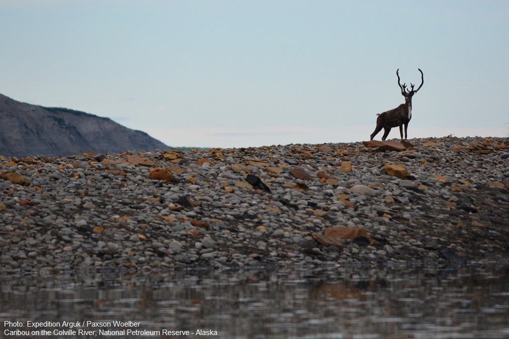
Since 2007, I’ve photographed in the Reserve on many extended trips. The region is a vast, roadless landscape of meandering rivers, majestic mountains, crystal-clear lakes, and mile after mile of tundra. The Reserve is also teeming with life, home to the Western Arctic Caribou Herd, the Teshekpuk Lake Caribou Herd, wolves, wolverines, and the highest density of grizzly bears north of the Brooks Range. Millions of terrestrial and aquatic birds come from across the globe to breed in the Reserve each summer.
It’s unfortunate that oil development occurs here, but if it must, BLM must ensure that any future decisions for development in the Reserve result in the smallest possible environmental footprint and minimize cumulative impacts. Protective measures must be put in place for the surrounding communities, wildlife and the Special Areas within close proximity to the development. BLM must not ignore the best available science and discount the feasibility of a more limited drilling option.
BLM’s management of the nation’s largest and wildest unit of public lands is toothless. One tooth is approved for drilling (GMT1) and a second tooth (GMT2) will be soon. BLM recently referred to GMT1 as “the first of several development projects that are likely to occur in the region over the next several decades.” BLM is preparing to allow full-bore development. Drill baby drill. Tooth after tooth. Without the strongest possible protections in place for the Reserve’s protected special areas, this is a dangerous path from which BLM cannot go back.
There’s simply no way to recover this fragile landscape once widespread industrialization occurs.
